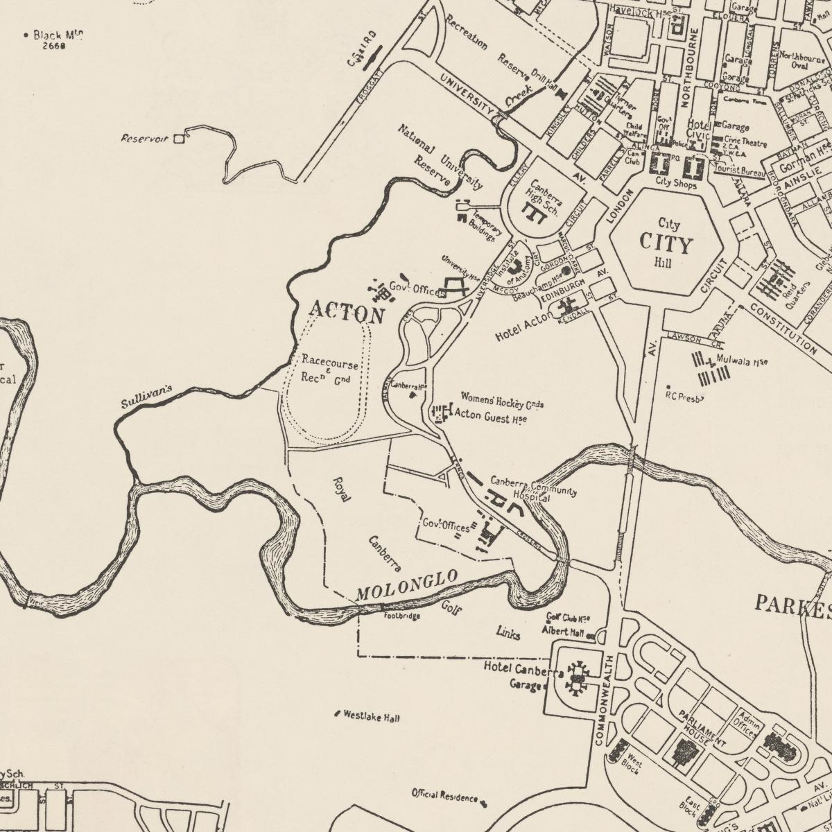
Acton Map 1950 showing Royal Canberra Golf Links
- Caption
-
Acton Map 1950 showing Royal Canberra Golf Links. Tourist plan Canberra 1950, compiled & drawn by Property & Survey Branch, The Department of the Interior, Canberra, A.C.T.
[This map cropped to show Acton. View original from the National Library of Australia Digital Collection]
- Date
- 1950
- Credit
- National Library of Australia: MAP G8984.C3E635 1950